
In the waters off Nan'ao, Shantou,
long-buried civilizations are gradually emerging from the depths.
During underwater archaeological work in Nan'ao, the Guangdong Provincial Institute of Cultural Relics and Archaeology employed the 'Underwater Communication and Navigation System,' independently developed by Ocean Plan. This system enabled integrated, three-dimensional networking between surface and underwater teams. Its application not only significantly improved the efficiency of underwater archaeology but also enhanced the safety of archaeological divers.
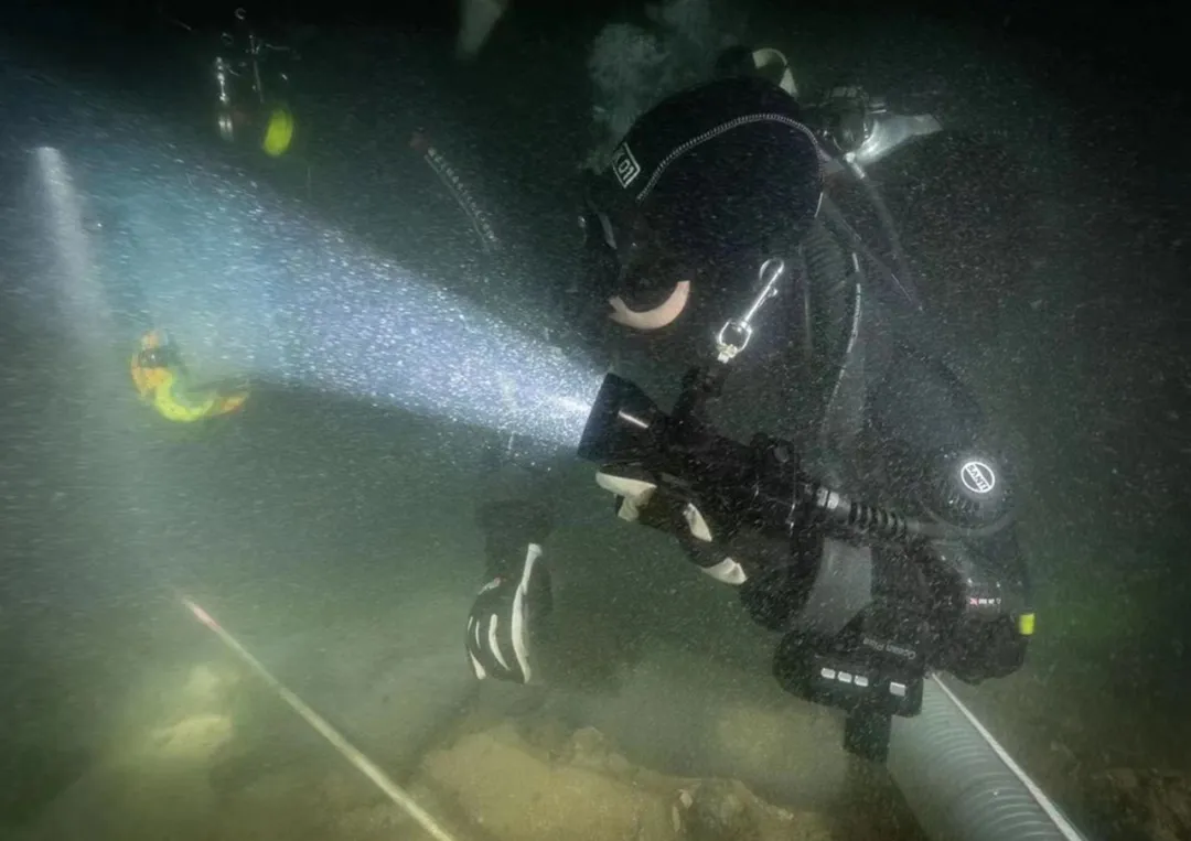
As China's underwater archaeology continues to advance, increasing numbers of shipwreck sites, ancient ports, and underwater cultural relics await discovery and study. According to the actual conditions of underwater archaeology along China's coast, most sites lie not far from the shoreline. As a result, underwater operations are often carried out in very poor visibility—typically around half a meter, and sometimes even zero. Complex hydrological and geological conditions can easily cause divers to lose their bearings underwater. Conventional communication methods fail beneath the surface, leaving divers and surface teams without effective means to communicate. All these factors pose serious risks to the safety of underwater archaeologists.
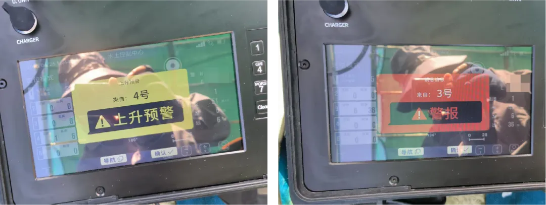
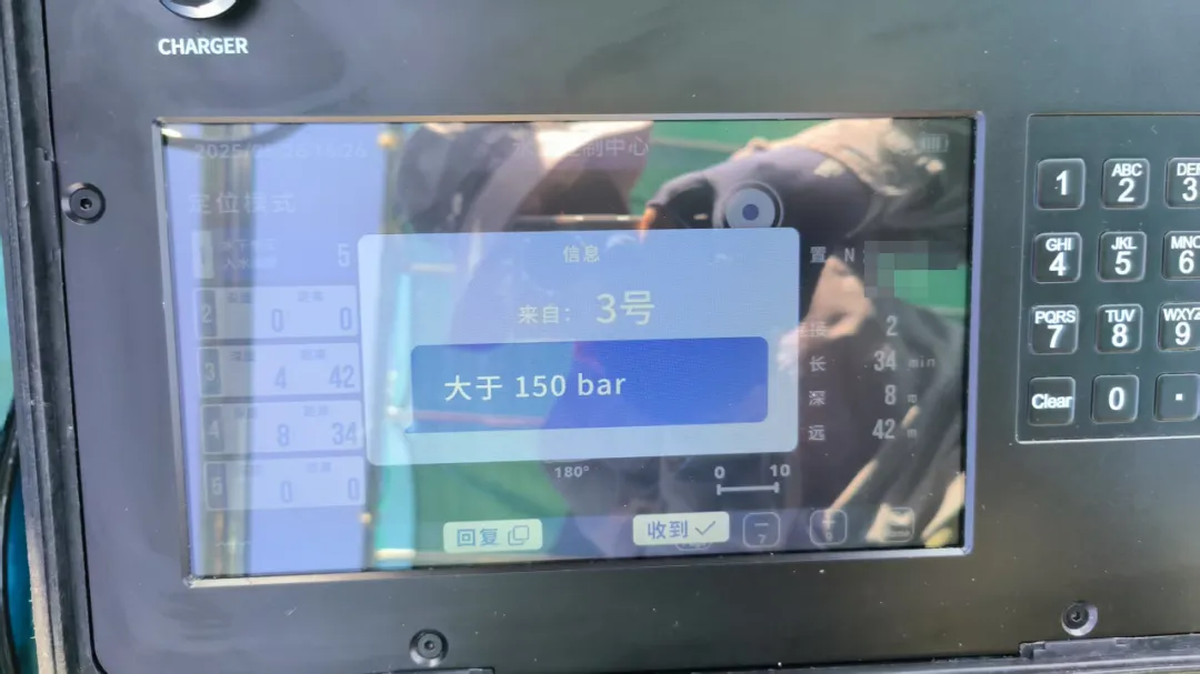
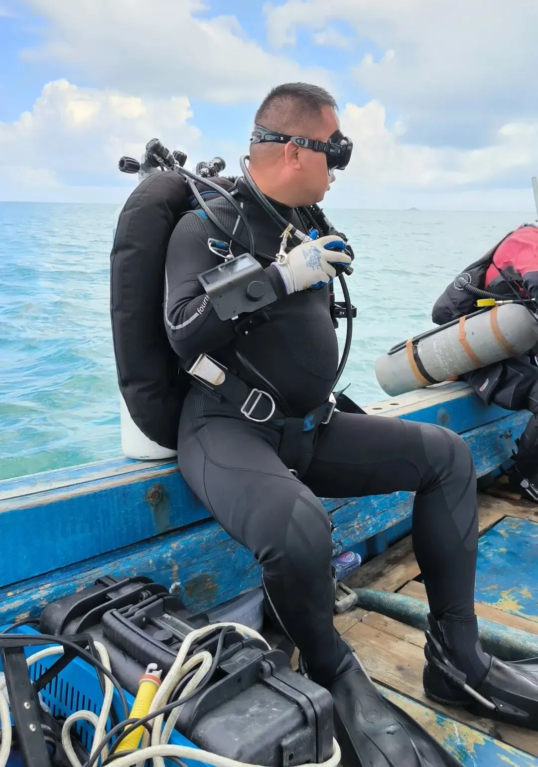
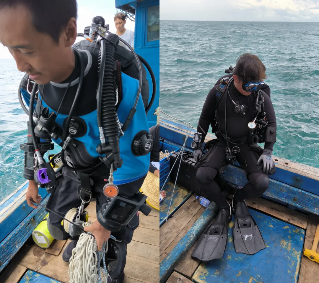
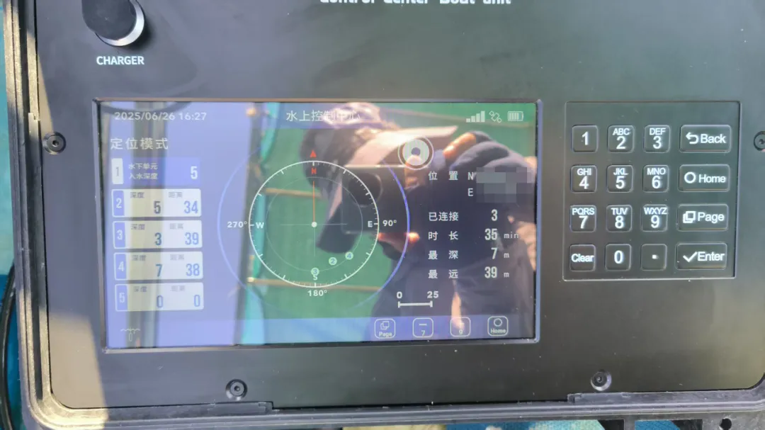
The 'Underwater Communication and Navigation System' used in the Nan'ao project consists of a dive navigation computer, topside control center, underwater locator beacons, and other components. It supports underwater real-time positioning, underwater 3D navigation, emergency distress signaling, abnormal-status alerts, and text communication between divers, as well as between divers and the surface command team. By establishing a three-dimensional underwater positioning and communication network, it solves the challenges of real-time underwater positioning and communication.
In practical application, the system supports several key operational scenarios:
Archaeological Clue-finding phase
Helps divers achieve accurate positioning and synchronized operational information in unfamiliar waters.
Site-marking phase
Uses underwater locator beacons to precisely locate relic sites, facilitating targeted follow-up work.
Underwater excavation phase
Divers wear miniature positioning terminals, allowing surface commanders to monitor their status and location in real time.
Underwater archaeology is not only a journey into history—it is also a fusion of technology and hands-on practice. The Nan'ao underwater archaeology project, through the practical application of the wireless underwater communication system, has enabled safer and more efficient deep-sea exploration. It brings new momentum to the protection and study of China's maritime cultural heritage.


